Sycamore Creek Restoration – Summit Park
Project updates can be found below and at our Facebook pages.
Ohio RIver Foundation was successful in assisting the City of Blue Ash (Ohio) in procuring a $257,000 Clean Water Act section 319 grant from Ohio EPA for restoration of Sycamore Creek, as a part of Blue Ash’s larger development of Summit Park. ORF provided grant drafting services and project development consultation.
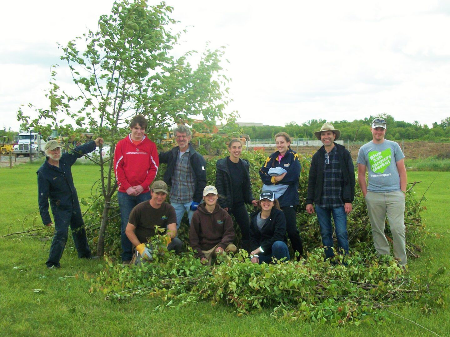
For the project, ORF is providing grant administration, invasive plant specie removal, volunteer coordination, and public meetings services.
Summary
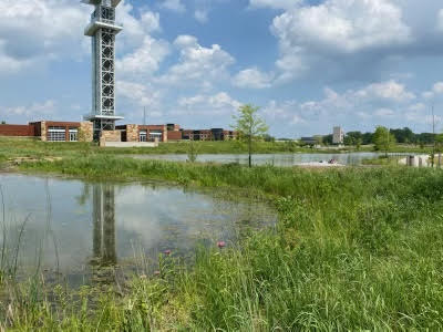
This project is an important part of a comprehensive long term restoration and water quality improvement program for the headwater watersheds that drain into the Sycamore Creek headwaters and then into the Little Miami River (LMR). This project furthers the goals of the approved TMDL and endorsed WAP for the Lower LMR watershed. The project will restore the natural stream ecosystem of this important 60 acre upland watershed that provides long duration base flow into this headwater stream of Sycamore Creek. The Project will capture and filter runoff from more than 120 acres, which includes an adjacent 60 acre multi-million dollar park development that is currently under construction (Blue Ash Summit Park).
Environmental Conditions
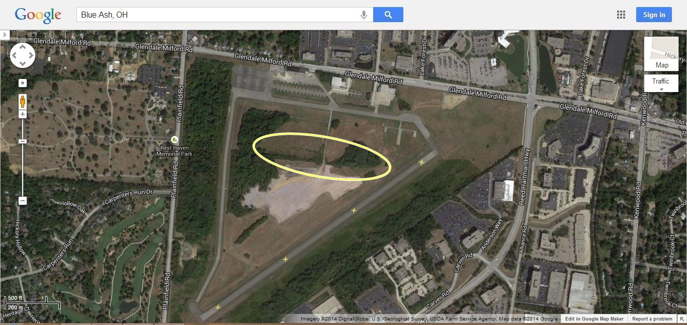
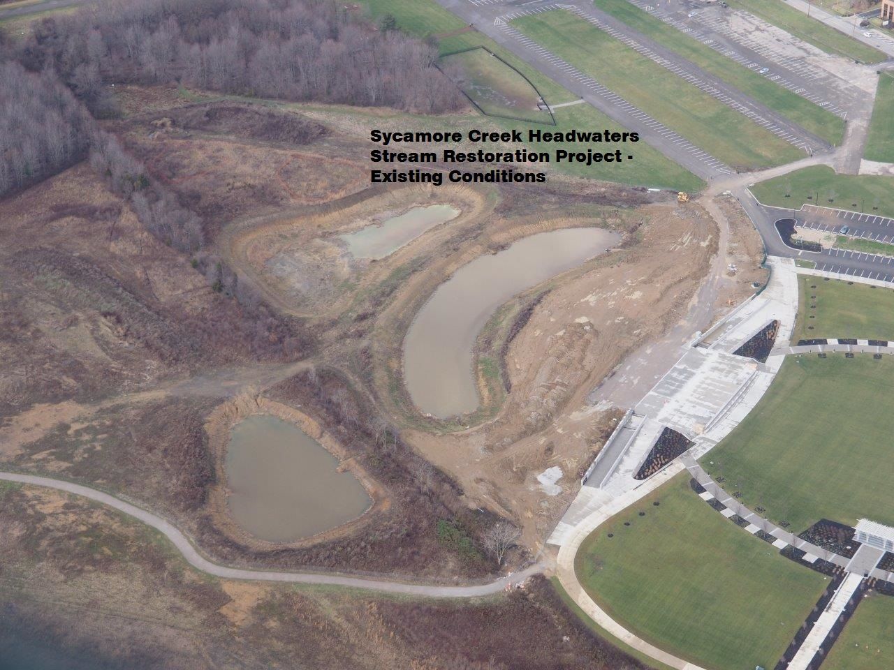
The project site is located in the northeast section of the City of Blue Ash in the headwaters of Sycamore Creek. This headwater sub-watershed is impaired by sediment and nutrients from past development activities. The endorsed 2010 Little Miami River Watershed WAP identified Sycamore Creek to have aquatic life impairment and the number of intolerant fish species is lower than receiving waters. The primary impairment results from stormwater runoff. The project watershed receives drainage runoff from a cemetery, a major public road, developed parcels, a forested wetland, and runoff from the former Cincinnati-Blue Ash airport. The project site is part of the redevelopment of the airport property into a regional public park (Summit Park – a concert and conference venue) that will serve the City and also draw an estimated 750,000 people from the region to public events. The historic stream channel meandered across an upland floodplain valley but was straight-ditched many years ago as part of the old Cincinnati-Blue Ash airport construction. The existing straight ditch (which is designated a “blue-line stream”) has eroded banks and was constructed across the side slope of a broad swale area to divert runoff from upland areas around the airfield runways and adjacent parking areas.
Project Description
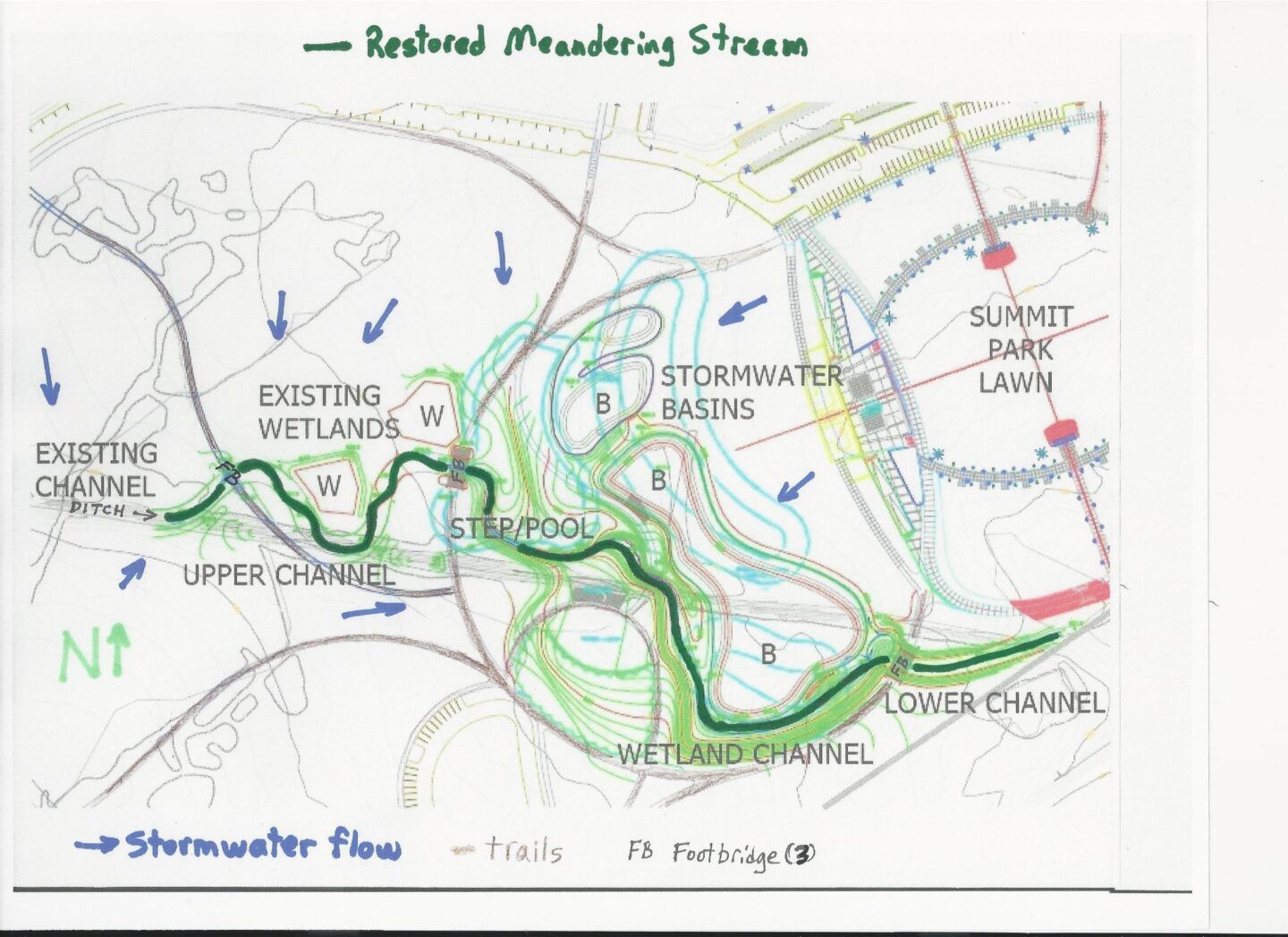
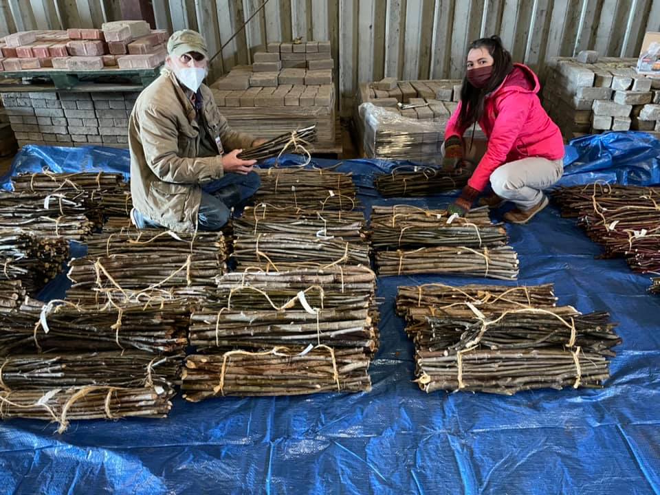
The proposed restored stream will receive runoff from 60 upland acres (including forested wetlands) and flow through four diverse structural and habitat zones. The project will also collect runoff from an additional 60 acres of redeveloped onsite park facilities for treatment through a variety of green infrastructure and high quality stormwater basins. To retain and filter development runoff 1400 lf of the existing ditch will be relocated and restored employing natural channel methodology. Furthermore, 30 lf will be daylighted, 2 small (1/4 acre) wetlands will be rehabilitated/restored from invasive to native wetland plantings and reconnected to the stream, and 3 stormwater basins will be constructed with wetland plantings. 35-50 different species of grasses, forbs, plants, etc., will be introduced and 200-300 native tree species (sycamore, cottonwood, etc.) will be planted on 4 acres of the Project site.
Stormwater runoff will no longer discharge into the existing 1400 lf narrow entrenched ditch, but instead will discharge from the existing upland forested wetlands, small restored/rehabilitated wetlands, and high quality stormwater basins into 1900 lf of restored natural stream channel and floodplain that follows the existing topography along the western upper channel. A step/pool channel system will help oxygenate flows to aid natural processes in removal of nutrients in the vegetated channel ecosystem.
The wetland channel section is adjacent to the much larger native vegetated perimeter shelves around the high quality stormwater basins for migration and interaction of native species across a diversity of natural habitats and creation of refuge areas during times of drought. The proposed natural stream channel and extensive wetland system will remove significant sediment, nutrients, and associated pollutants contained within runoff from the site (that would otherwise be discharged into the ditch) and will assimilate much of the nitrogen and phosphorus. Currently, using ODNR R5 model, the identified contaminant reductions will be: sediment – 31tons/yr; phosphorus – 35 lbs/yr; and nitrogen – 105 lbs/yr. Thus, despite an increase in impervious surface with the on-site Summit Park development, this Project will result in a net decrease in stormwater pollution.
This project is scheduled to be completed in 2017.