The Ohio River and Its Watershed
Ohio River Watershed
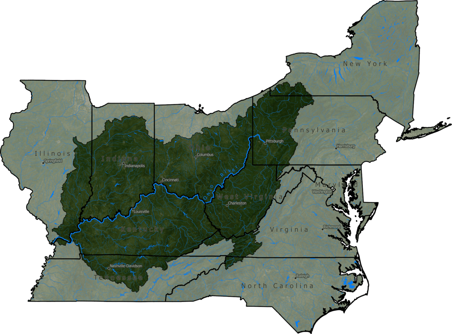
- The Ohio River is 981 miles long, starting at the confluence of the Allegheny and the Monongahela Rivers in Pittsburgh, Pennsylvania, and ending in Cairo, Illinois, where it flows into the Mississippi River.
- The Ohio River flows through or borders six states: Illinois, Indiana, Kentucky, Ohio, Pennsylvania and West Virginia. In addition, water from parts of New York, Virginia, North Carolina, Tennessee, Maryland, Mississippi, Georgia and Alabama drain into tributaries that empty into the Ohio.
- The Ohio River is the source of drinking water for more than five million people.
- More than 25 million people, almost 10% of the US population, live in the Ohio River Basin.
- There are 20 dams on the Ohio River, managed by the Army Corps of Engineers. The dams have greatly changed the flow of the river, creating a series of very slow moving pools rather than a free flowing river. This makes the river muddier, which is harmful to bottom-dwelling species. In addition, the Corps regularly dredges the river, disrupting wildlife and increasing turbidity.

